

 TRENDING
 Flood Maps
Explore how rising sea levels could flood different areas of the world using interactive maps.
Try Flood Maps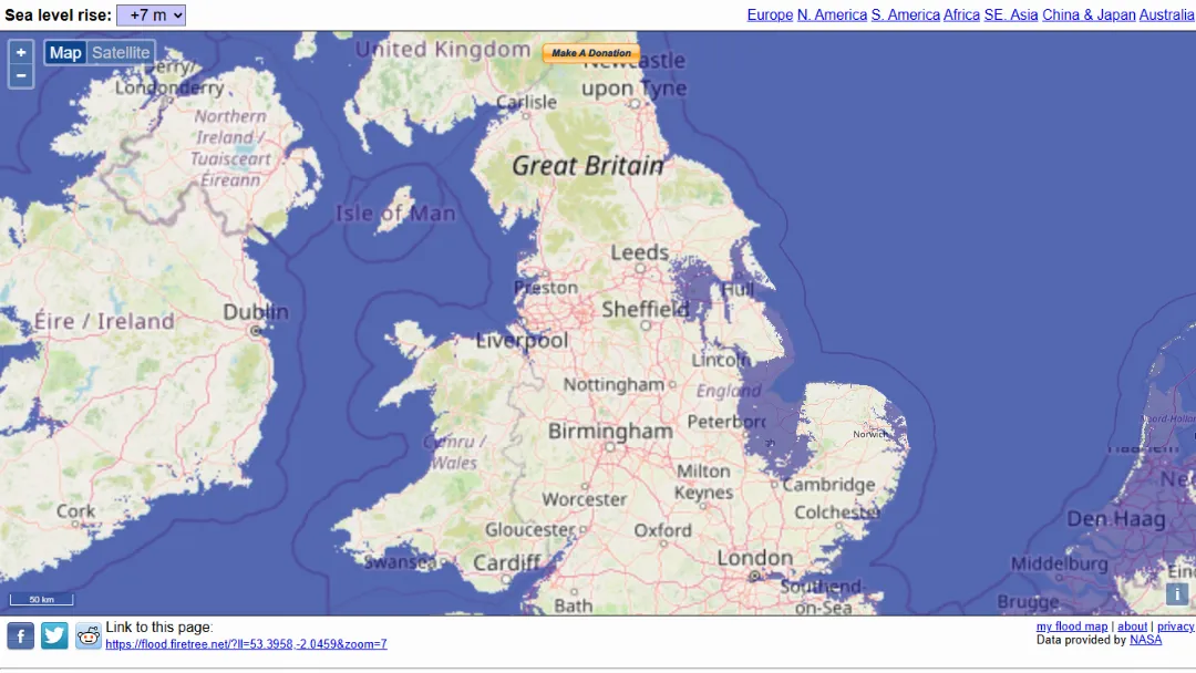
What is Flood Maps?
Try Flood MapsFlood Firetree is an online mapping tool that visualizes the potential impact of sea level rise caused by climate change. It allows users to simulate flooding scenarios by adjusting water levels and instantly seeing which regions would be submerged. The platform uses geographic and elevation data to create dynamic, interactive maps that reflect possible future flooding conditions.
The website is particularly useful for understanding environmental risks, climate change consequences, and coastal vulnerability. Users can explore different regions globally and observe how increasing sea levels—from small rises to extreme scenarios—would affect cities, coastlines, and low-lying land areas.